Sifra North
Following a tender process, we were awarded a government concession to conduct exploration in the designated area known as “Shifra North.” This project is named after Shifra, the late wife of the company’s chief geologist, Dr. Yuri Voloz.
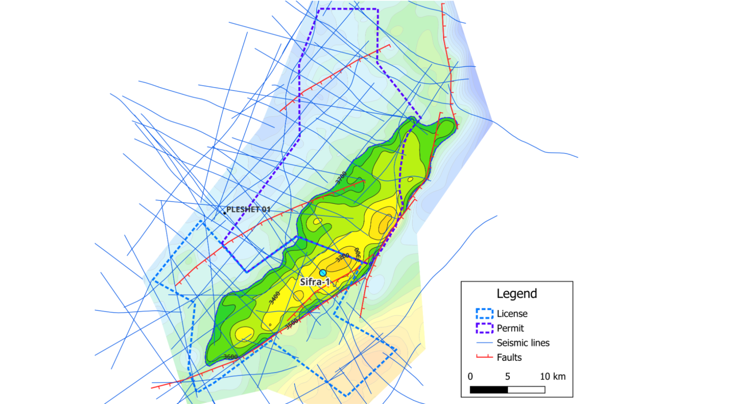
With the establishment of Mozestro, data from the subsoil in southern Israel (the blue lines in the illustration on the left) was collected and processed by the company’s geological and geophysical team using unique, world-leading geophysical processing methods developed by the Israeli company Geomag. These methods enable a significant improvement in subsurface imaging compared to previous data. The improvement in data quality has led to new mapping capabilities and a new scientific geological perspective on the geological structure of southern Israel. The map on the left shows the geological structure of the Triassic roof subsurface. The top of the structure is located in the Shifra North license and continues in the early permit to the north.
A look at the seismic images below highlights the enormous difference in the imaging capabilities of the subsurface before and after applying the new algorithms to the data. The significant improvement in the imaging of the deep layers is clearly visible. The cross-section shown reflects a slice of rock at a depth of up to approximately 5 km. In the center of the cross-section, an anticline structure resting on an inverted fault can be seen. This fault is not identifiable in the data prior to reprocessing.
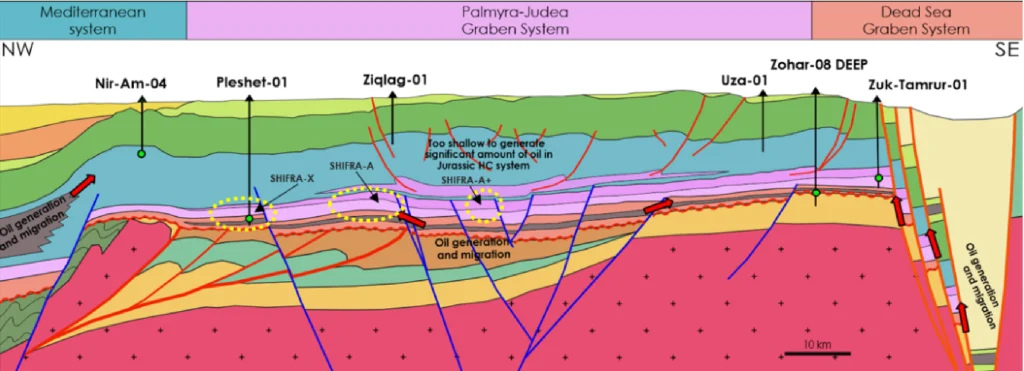
Geological cross-section from the Mediterranean Sea to the Dead Sea
The geological cross-section shown is a cross-section from the Mediterranean Sea (left) to the Dead Sea Rift (right). The cross-section shows known oil-forming systems such as those of the Dead Sea and the Mediterranean Sea. However, the system appearing in the center of the cross-section is unknown and is proposed here for the first time.
This new model proposes two significant changes in the hydrocarbon systems in southern Israel: the existence of source rock at a depth from the Paleozoic era and a seal rock in the Triassic roof supported by reverse faults. This combination explains the absence of reservoirs in the shallower geological layers and the possibility of finding deep reservoirs. Based on this model, Musestro has selected exploration licenses for drilling that will enable testing of the model in the area. Due to the large physical size of the identified geological structure (Shifra North), there is an expectation of finding a large gas reservoir if the model is indeed confirmed.